
Things To Do

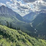
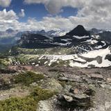
Lone Pine State Park Hike *
This hike is easily accessible from Kalispell and is a Maskill-family go-to spot! Many summer evenings were spent watching the sunset from Lone Pine, or watching Kevin flex (see picture). The listed address takes you near the top of lone pine. If you prefer a longer hike you can park at the bottom. The website has a map and more information about the park. Make sure to check out the Flathead Valley view point illustrated on the map with the camera icon. For the full experience, jump in nearby Foys Lake afterwards! See link for driving directions to the lake: https://maps.app.goo.gl/2d9aFLWD7NXbh1jT8?g_st=i&utm_campaign=ac-im).
Mount Aeneas Hike *
If you’re looking for a Paige classic, this is it! Not far from where she grew up, Mount Aeneas is located in the Jewel Basin wilderness area. Start at noisy basin trailhead. You can either do it as an out and back to the peak (about 6 and a half miles total and 2000 ft of elevation gain) or as a loop down to picnic lakes (about 7 and a half miles total and 2400 ft of elevation gain).
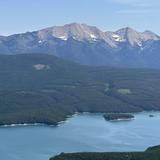
Wayfarers State Park *
Flathead lake is located just south of Kalispell. It is the largest natural freshwater lake in the western United States. There are multiple state parks on the lake including Wayfarers, Big Arm, Finley Point, and West Shore. If you’re wanting to replicate a day in the life of Paige during her high school summers, go to Wayfarers state park for some swimming or cliff jumping and then go to the Dairy Queen in Bigfork for a blizzard!
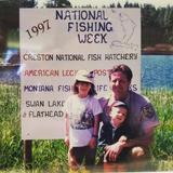
Creston National Fish Hatchery *
This is an iconic Maskill site-seeing destination! Not only did Paige’s dad, Mark Maskill, manage the hatchery for many years, but this is where Paige and Kevin grew up during their summers in Montana. You can tell by the picture that Paige was already well on her way to becoming a biologist. Check out that fish coming out of her hat and the elk t-shirt!
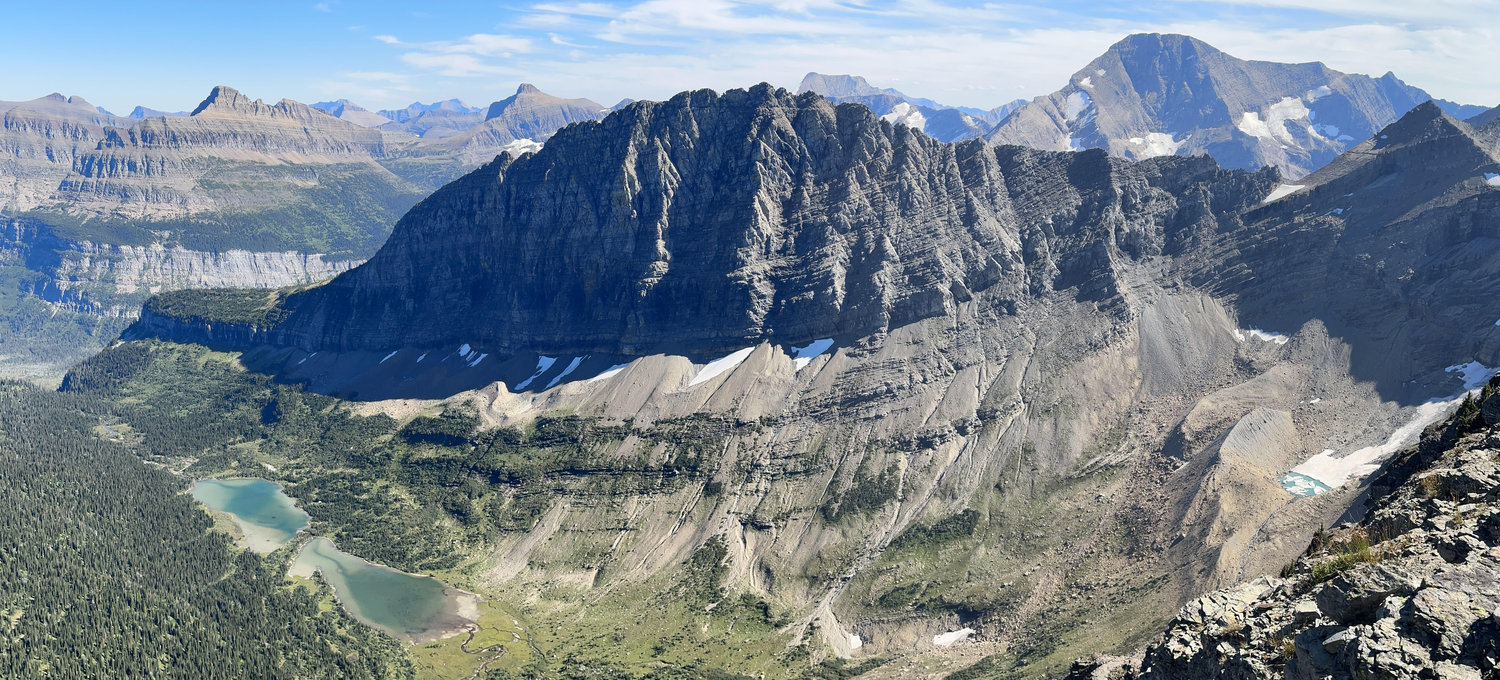
Going-to-the-Sun Road Scenic Drive
This road is an iconic 50 mile scenic highway in Glacier National Park. The road typically opens in the spring/early summer once the snow has been cleared. The road starts at the park entrance in West Glacier. There are multiple scenic view points along the road including Apgar village with views of Lake McDonald, pullouts along McDonald creek, bird woman falls overlook, the weeping wall, and Logan’s pass. If you still feel like driving, keep going down the other side of the pass to St. Mary’s. Consider stopping at sun point for views down St. Mary’s lake. You can either drive back the way you came over Logan’s Pass or through East Glacier and Essex back to West Glacier. Per google maps the driving time both ways is similar. To enter Glacier Park you need to have a park pass AND a vehicle reservation (unless you are entering the park before 7 am or after 3 pm). You can purchase a park pass at the entrance but need to get your vehicle reservation in advance.
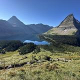
Hidden Lake Overlook Hike
This hike is in Glacier and starts from Logan’s pass. A majority of the trail is a boardwalk and can feel like you’re on a stair stepper! The hike is 2.6 miles round trip with 550 ft of elevation gain. This is a popular trail but very easily accessible and beautiful. It can be hard to find a parking place at Logan’s Pass so make sure to give extra time in case it’s crowded. To enter Glacier Park you need to have a park pass AND a vehicle reservation (unless you are entering the park before 7 am or after 3 pm). You can purchase a park pass at the entrance but need to get your vehicle reservation in advance. See the park website for more details about how to get the vehicle reservation: https://www.nps.gov/glac/planyourvisit/goingtothesunroad.htm
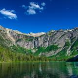
Avalanche Lake Hike
This hike is in Glacier and starts at the Avalanche campground trailhead. You start on the trail of the cedars and continue to avalanche lake. The hike is about 5 miles round trip with 700 of elevation gain. This trail is very popular and can be crowded but the views from the lake are spectacular. To enter Glacier Park you need to have a park pass AND a vehicle reservation (unless you are entering the park before 7 am or after 3 pm). You can purchase a park pass at the entrance but need to get your vehicle reservation in advance. See the park website for more details about how to get the vehicle reservation: https://www.nps.gov/glac/planyourvisit/goingtothesunroad.htm
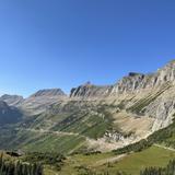
Highline Trail Hike
This hike is in Glacier and can be as mellow or strenuous as you want. For a short option, start at Logan’s pass. Walk out the highline trail as far as you want and then turn back around. If you want a long hike and prefer more down, start at Logan’s pass and walk the highline trail down to the Loop. The total mileage is 11.5 and approximately 1600 ft up and 3900 ft down. If you prefer a long hike with more uphill, go in the opposite direction. If that still isn’t enough, add on the Grinnell Glacier Overlook trail or Swiftcurrent lookout. A shuttle would need to be arranged either using glacier park’s shuttle system or your own group. To enter Glacier Park you need to have a park pass AND a vehicle reservation (unless you are entering the park before 7 am or after 3 pm). You can purchase a park pass at the entrance but need to get your vehicle reservation in advance. See the park website for more details: https://www.nps.gov/glac/planyourvisit/goingtothesunroad.htm
Mount Oberlin Hike
This hike is in Glacier and starts from Logan’s pass. This might be a good option if you want good bang for your buck. The trail is 3.4 miles total with 1500 elevation gain. There are beautiful views from the start and then 360 degree glacier peaks at the top. It can be hard to find a parking place at Logan’s Pass so make sure to give extra time in case it’s crowded. To enter Glacier Park you need to have a park pass AND a vehicle reservation (unless you are entering the park before 7 am or after 3 pm). You can purchase a park pass at the entrance but need to get your vehicle reservation in advance. See the park website for more details about how to get the vehicle reservation: https://www.nps.gov/glac/planyourvisit/goingtothesunroad.htm
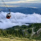
Big Mountain
Whitefish mountain resort (aka Big Mountain) Big Mountain, located just north of Whitefish, is a ski resort in the winter and has a variety of activities in the summer. As Paige once said while skiing there in high school, “It’s a big mountain! It definitely deserves to be called big mountain.” Hiking: Danny on trail goes to the top of the mountain. The trail is 4 miles each way with 2200 feet of elevation gain. Biking: You can rent a bike in town or up at the mountain. You bike up the summit trail, which is 7.4 miles and 2100 feet of elevation gain. You can also buy a lift ticket and do multiple laps up the chairlift with your bike. Scenic lift ride: You can buy a one way or round trip up the chairlift/gondola. From the top there are great views of the Flathead Valley and into glacier! Zip lines, alpine slide and aerial adventure park: Lots of activities for the whole family! The website includes info about activities, weather and webcams
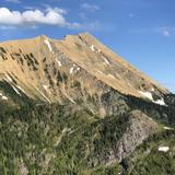
Great Northern Hike
This is a great hike if you’re looking for a big adventure! The first two miles are in the woods and quite steep. Once you reach the ridge the views are amazing and last for hours. There is some exposure on this hike. From the top you can see into Glacier and down Hungry Horse reservoir. Round trip mileage is about 7.4 miles and 4700 feet of elevation gain. The last two miles down are a quad crusher.
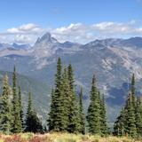
Scalplock Mountain Fire Lookout Hike
This hike is in the Middle Fork drainage, which makes up the southern boundary of Glacier Park. You do not enter Glacier and therefore do not need a park pass or vehicle reservation. The hike is 7 miles round trip and 3000 feet of elevation gain. The trail is well maintained and straight forward. Most of the hike is in a pretty forest. From the lookout there are 360 degree views into Glacier and the surrounding wilderness areas.
Hungry Horse Reservoir
Depending on where you’re staying in the valley, the reservoir is about 20-40 minutes away. Past the dam the road follows the shore with pretty views of the water, islands and the mountains in the Great Bear Wilderness. There are several day use areas where you can hang out and swim. One of the most accessible places to hang out on the water is Lost Johnny Campground day use area.
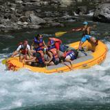
Great Northern Rafting
The Flathead river makes up the border of much of the western and southern edge of Glacier National Park. There are several ways to get on the river, including whitewater rafting, flyfishing and scenic raft trips. There are multiple guide companies based out of West Glacier. One of the local favorites is Great Northern.
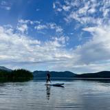
Paddle Board or Kayak Rentals
Whitefish Lake State park: https://www.tourglacier.com/whitefish-lake-state-park-rentals Whitefish City Beach (also rents e-bikes): https://whitefishoutfitters.com/rentals/ Sportsman Ski Haus Kalispell and Whitefish locations (pick up rentals and take anywhere): https://www.sportsmanskihaus.com/info/ssh-rentals
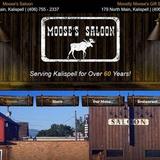
Moose's Saloon
Moose’s Saloon has a great combo of pizza and culture!