Travel/accommodation
Travel Note
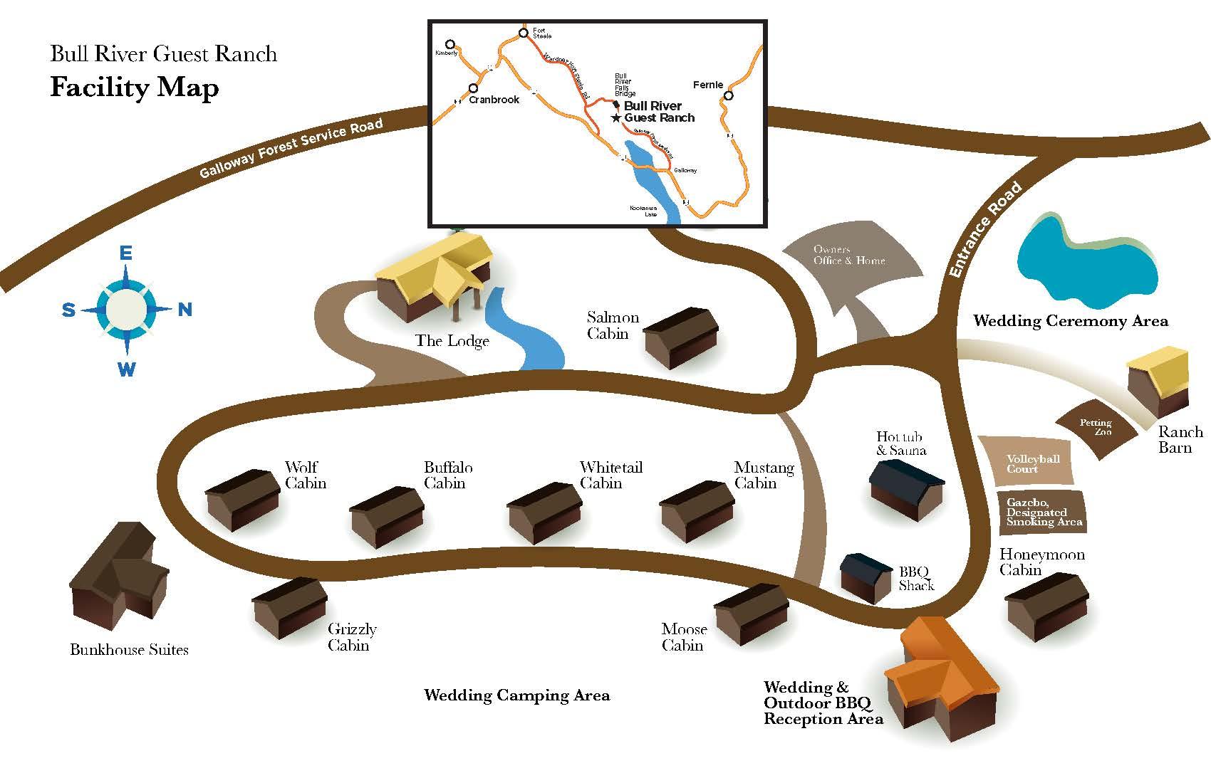
How to get there
You are in for a taste of our lifestyle. Part of the reason we chose this venue was the relation the experience has to our normal adventures. While traveling to the BRGR you may get the sense that you have taken a wrong turn. We both enjoy finding a remote spot to explore and enjoy the anticipation of wondering if you are on the right track.
Travel Note
Travel from fernie to BRGR
Getting Here These directions are better than Google Maps. Google Maps will take you through the Pickering Hills – this route is illegal for motorized vehicles and is unsafe. If you get stuck on the Bull River Road, please contact Kirk with the Jaffry Tow Truck Service: KMB Autobody (250-919-4670) . From Fernie (Approx. 55 min) 1. Take Crowsnest Hwy / BC-3 W through Jaffrey 2. Turn right onto Wardner Fort Steele Road (8.3 km) 3. Slight right onto Galloway Forest Service Road (1.9 km) Note the sign will say “Bull River Road”, regular maps will say “Bull River Road”, google maps will say “Galloway Forest Service Road Note that on the Bull River Road, you will pass the Bull River mine on the left-hand side; following, you will drive down a steep canyon and cross over the Bull River Falls bridge. Once past the falls, keep right at the Y and you will start to see little yellow signs. These signs are logging km signs that will help direct you. 4. Continue straight on Galloway Forest Service Rd (15 km) 5. Take the left-hand turn at km 17 down into the ranch
Travel Note
Travel from Cranbrook to BRGR
Getting Here These directions are better than Google Maps. Google Maps will take you through the Pickering Hills – this route is illegal for motorized vehicles and is unsafe. If you get stuck on the Bull River Road, please contact Kirk with the Jaffry Tow Truck Service: KMB Autobody (250-919-4670) . From Cranbrook (Approx. 45 min) 1. Head northwest on Crowsnest Hwy Van Horne St N/BC-3 E/BC-95 N toward 1 St N 2. Continue to follow Crownest Hwy/BC-3 E/BC-95 N (~9 km) 3. Merge right onto Kootenay Hwy BC-93 N/BC-95 (signs for Invermere/Radium/Golden) (~7 km) 4. Turn right at Fort Steele Esso onto the Fort Steele/Wardner Road 5. Take Fort Steele/Wardner Road for 22 km 6. Turn left onto Bull River Road Note the sign will say “Bull River Road”, regular maps will say “Bull River Road”, google maps will say “Galloway Forest Service Road Note that on the Bull River Road, you will pass the Bull River mine on the left-hand side; following, you will drive down a steep canyon and cross over the Bull River Falls bridge. Once past the falls, keep right at the Y and you will start to see little yellow signs. These signs are logging km signs that will help direct you. 7. Continue straight on Galloway Forest Service Rd (15 km) 8. Look out for the yellow signs with numbers along the road, they are logging km signs that will help direct you 9. Take the left-hand turn at km 17 down into the ranch