

Travel
Flight
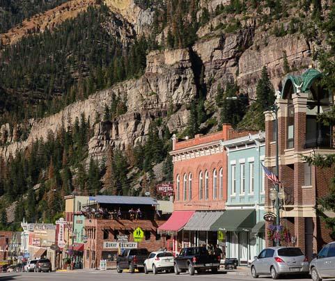
Getting to Ouray
Montrose Regional Airport: 38 miles from Ouray (50-60 minute drive) Grand Junction Regional Airport: 102 miles from Ouray (2 hour drive) Denver International Airport: 325 miles from Ouray (6-7 hour drive) If driving to Ouray from Denver, CO, consider taking Highway 285 to Poncha Springs, CO, and then highway 50 to Montrose, CO when traveling as an alternate route to I-70. It’s a very scenic drive that will take you through the heart of Colorado’s mountain towns. If you choose not to rent a car, potentially there are airport shuttles from the regional airports to Ouray: https://montroseairport.com/190/Airport-Shuttles https://www.gjairport.com/Ground_Transportation
Rental Car
Car Rental
There are no options for passenger car rentals in Ouray (besides ATVs and Jeeps). Make arrangements to pick up a rental car at the airport on your arrival to the area. Consider Budget rental in Montrose for a good selection of pickups. If you want to be able to drive directly to the Lodge, you'll need a pickup or jeep with 4WD low. Otherwise, let us know and we can coordinate a ride from the 2WD road up to the Lodge. There is also the option of carpooling, and we're happy to help coordinate guests depending on arrival/departure plans.
Travel Note
Directions to Lodge
No cell service up in the mountains! Satellite wifi will be available at the Lodge. Save screenshot of directions to phone before leaving Ouray. Mount Hayden Backcountry Lodge is located at Latitude/longitude: 37.9568, -107.7205 Directions from Ouray, Colorado: Heading out of town - Leave the south end of town on Hwy. 550. Directly after the big horseshoe bend (about ¼ mile), take a right on CR 361 (Camp Bird Rd.). Follow this for 4.7 miles, then take the broad left fork that goes toward Camp Bird Mine. In another 0.3 miles you’ll reach a bridge. Park just before here if hiking. Otherwise, switch to 4 low if jeeping. There is not a sign for the mine. Heading up the jeep road to the Lodge - Must have an off-road ready, high clearance 4WD vehicle, (not SUV or AWD)! Arrive at the bridge described above at Camp Bird. Then follow the Imogene Pass jeep trail 1.8 miles from the bridge at Camp Bird in your off-road vehicle crossing the river once, until you see a sign to go left up Richmond Basin, just beyond a wooden bridge (not to be crossed). It’s a sharp left, usually a three point turn. Follow the road up for 0.4 mile to a small wooden sign that reads "Richmond Trail ½ mile" with an arrow to the right. Instead follow the road to the left! This will lead you in 200 yards to Mount Hayden Backcountry Lodge! Park after crossing the small creek on your left.