Things To DoThings To Do
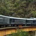
El Chepe TrainEl Chepe Train
It is a major rail line in northwest Mexico, linking the city of Chihuahua to Los Mochis and its port, Topolobampo. It crosses the Sierra Madre Occidental, part of the range that in the United States is called the Rocky Mountains. There is no road covering the trajectory. It runs 418 mi, traversing the Copper Canyon, a rugged series of canyons that have led some to call this the most scenic railroad trip on the continent. The tracks pass over 37 bridges and through 86 tunnels, rising as high as 7,900 ft above sea level near Divisadero (the continental divide), a popular lookout spot over the canyons. Each one-way trip takes roughly 16 hours. The track also crosses over itself to gain elevation.
CreelCreel
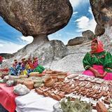
Creel is a magic town. In Mexico, Pueblos Mágicos, or "Magical Towns," are specifically designated localities recognized for their unique cultural, historical, or natural significance. These towns are promoted by the Mexican government as tourist destinations, aiming to showcase the country's rich heritage and diversity. Creel is a town in the Sierra Tarahumara (part of the Sierra Madre Occidental) of the Mexican state of Chihuahua. It is notable for being inhabited mostly by Native Americans of the Rarámuri ethnic group, and the use of their native language is widespread in the population in daily life and public events such as church masses. Creel was historically a logging town, although tourism has become the primary job source over the last 20 years because it is close to the Copper Canyon as well as Basaseachic Falls, one of the highest waterfalls in Mexico. There are many hotels, restaurants and a number of tours down into the canyons and throughout the surrounding area.
Copper CanyonCopper Canyon
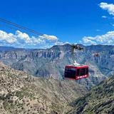
Copper Canyon (Spanish: Barrancas del Cobre) nestled in the Sierra Madre Range, is actually several large canyons boasting a grandeur four times larger than the Grand Canyon of the United States, although different in nature; narrower, deeper, and more verdant. Homeland to the reclusive Tarahumara natives, the Sierra Madre is rich in history and legend, haunted by the restless shadows of fallen warriors, martyred Jesuits and Pancho Villa’s army. The Copper Canyon qualifies unquestionably for national park and world heritage status. This world famous canyon system is one of Mexico’s natural, cultural and historic wonders. Located in in the middle of the legendary Sierra Madre Mountains of the northwestern Mexico’s state of Chihuahua, this immense series of canyons and ridges, covers 25,000 square miles of rugged territory.
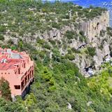
Hotel Mirador in Copper CanyonHotel Mirador in Copper Canyon
If you decide to go to Cooper Canyon, here is this hotel we love and highly recommend! It is located right there! With amazing views! It is a show!
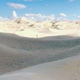
Samalayuca Dune FieldsSamalayuca Dune Fields
The Samalayuca Dune Fields, In Spanish "Dunas de Samalayuca", are a series of large but separated fields of sand dunes located in the northern part of Chihuahua. The dune fields are located in a 2000 km2 area known as the Samalayuca Desert. The best known portion of the Samalayuca Dune Fields lie in and around the village of Samalayuca. These dune fields lay across the much traveled north–south route between Chihuahua City and "The Pass of the North" at the site of the border cities of Ciudad Juárez and El Paso, Texas. Before the era of the modern highway and railroad, travel by foot, horse or oxen across this extended barrier of some 30 kilometers of loose sand was laborious and dangerous, but travelers had the option of a longer (and thus more time-consuming) detour around the east side of the dune fields. The dunes are composed of almost pure quartz sand that is white to tan in appearance and formed by Aeolian deposition.