
Travel
Travel Note
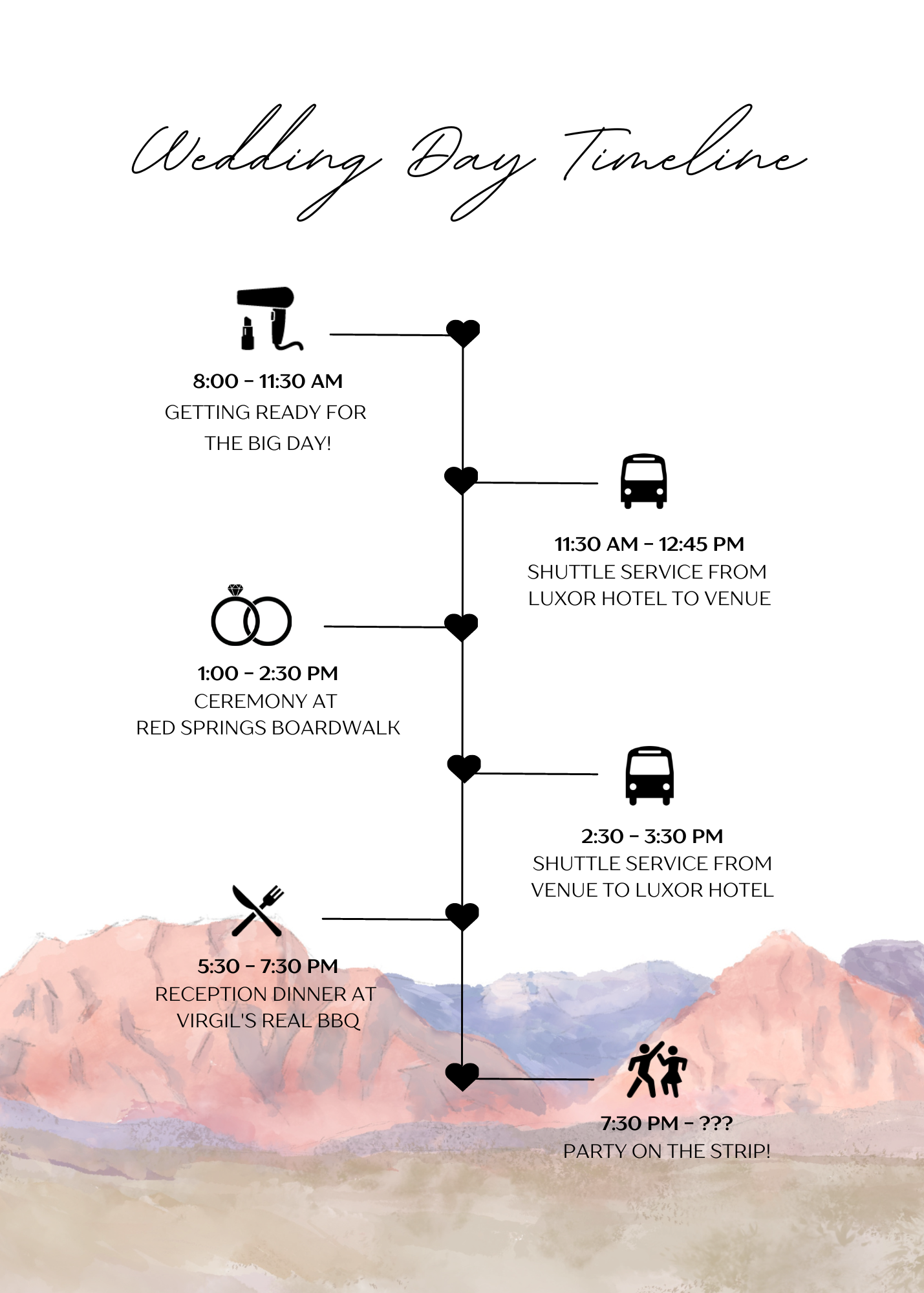
Red Springs Boardwalk - Calico Basin
Directions to Get to the Trailhead: Red Spring Picnic Area is located off of Calico Basin Road, just north of State Route 159, 1.4 miles East of the Scenic Drive in Red Rock Canyon National Conservation Area. From Las Vegas, take Interstate 15 to Exit 42 and follow Route 95 West for 5 miles (heading towards Reno). Take Exit 81A for Summerlin Parkway and drive 6.5 miles, using a ramp on the right to get on Clack County Route 215 South. Drive 2.2 miles, taking exit 26 to reach an intersection with Route 159 (Charleston Boulevard). Turn right and drive 3.7 miles to Calico Basin Road. Turn right and drive 1.2 miles to the Picnic Area Parking Lot, which will be up a road to the left. Trailhead Address: Red Spring, Calico Basin Road, Red Rock Canyon National Conservation Area, Las Vegas, NV 89161 Trailhead Coordinates: 36.14652, -115.4191 (36° 08′ 47.47′′N 115° 25′ 08.76′′W)
Hotel
Luxor Hotel & Casino
This is where we will be staying for the entirety of our Wedding and the few days after!
House Or Rental
Palms Place Suite with Balcony Views
Studio condos just off of the Strip, with complimentary shuttles available from 11am to 8pm!